Ludbreg before Ludbreg – Archaeological Excavations of Ancient Iovia
Ancient Iovia (civitas Iovia - Botivo) was built in the early Roman imperial period on the important road route which linked Ptuj (Poetovio) and Osijek (Mursa), two large centres of the province of Pannonia. The spatial organisation of Iovia overlaps with the area of the wider centre of present-day town of Ludbreg. Iovia was probably destroyed during the Gothic incursion in the late 4th century. The archaeological excavations carried out by the Division for Archaeological Heritage of the Croatian Conservation Institute between 2008 and 2011 in the centre of the present-day town of Ludbreg (Somođi Garden) were a continuation of systematic test-pit excavations carried out in the wider town zone by the Archaeological Museum in Zagreb.
Iovia in a Few Words
Ancient Iovia (civitas Iovia - Botivo) was built in the early Roman imperial period on the important road route which linked Ptuj (Poetovio) and Osijek (Mursa), two large centres of the province of Pannonia.
Good connection to the southern part of the province of Pannonia was provided by the vicinity of Varaždinske Toplice (Aquae Iasae), and the road leading to it from Sisak (Siscia). It is assumed that Iovia, which was structured in line with the natural configuration of the land on the left bank of the River Bednja, was originally a military fort (castella, castra) within the Drava limes system. Furthermore, it is assumed that Iovia was originally known as Botivo, and that this settlement grew to a town (civitas) by the end of the 3rd or at the very beginning of the 4th century. But, for the moment these assumptions can not be confirmed.
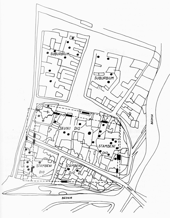
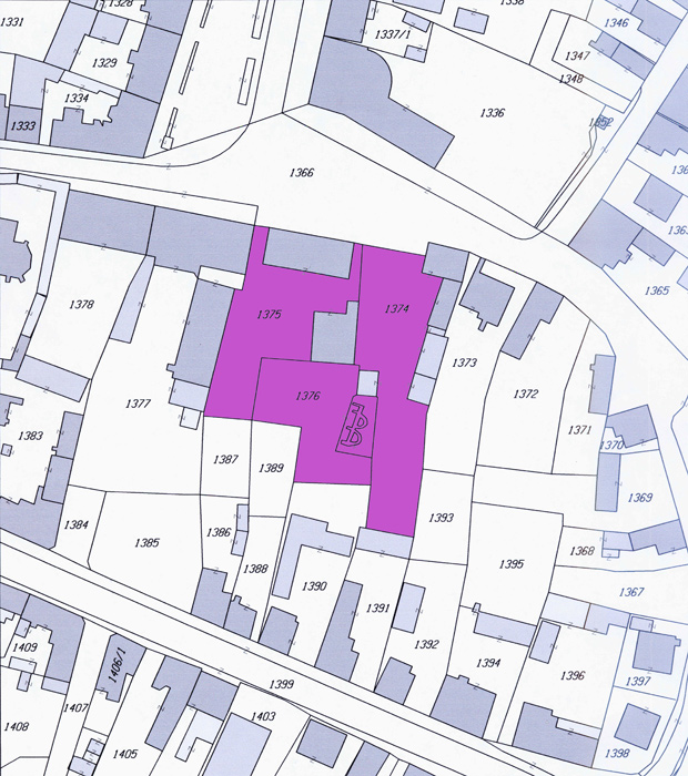
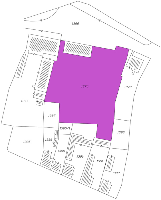
Despite the extensive test-pit excavations in the wider area of Ludbreg, carried out by the Archaeological Museum in Zagreb between 1968 and 1979, the ground plan of Iovia cannot be ascertained. It is assumed that the core was protected with defensive walls, and that it covered about nine hectares. In the centre of today’s Ludbreg, baths and other (presumably) public facilities have been found. The residential facilities and outbuilding structures discovered in the surroundings of the Batthyány Castle suggest that in this zone the suburbs (suburbium) were located.
The most interesting results that came to light in the test trenches in 1969 were two semi-circular bath pools in the Somođi Garden, a large private estate in the very heart of the present-day town. Based on the interpretation of the aforementioned pools as baths that were remodelled and converted into a Christian church (as done in nearby Aquae Iasae) and R. Egger’s theory, many scholars were eager to accept the hypothesis that Croatian Iovia was where Arian Bishop Amantius was exiled after the Council in Aquileia in AD 381. A great deal of scholarly importance was attached to the continuation of research in order to discover another piece of the puzzle that would resolve the long-lasting debate on the Iovian diocese (and knowing that the Croatian part of the Roman province of Pannonia has not been sufficiently examined because later settlements were built over their Roman predecessors). Fortunately, even though the present town of Ludbreg entirely covers the general layout of the Roman settlement, it was possible to launch excavations on a larger scale due to the large amount of open space that defined the southern portion of the Somođi Garden.
Phto Album

After several centuries of prosperity, Iovia was most likely devastated during the invasion of the Goths in the late fourth century AD. The tradition of urban life was not abandoned; instead, this Pannonian town has existed in continuity up until today
Archaeological Excavations of Iovia between 1968 and 1979
A team of experts from the Archaeological Museum in Zagreb explored the heart of Ludbreg's town centre for nearly an entire decade, between 1968 and 1979. Unfortunately, the exploration mostly consisted of opening test pits, limited by the boundaries of private estates. The results included finds of public and residential buildings and workshops, built of yellowish-white lithothamnion, and an abundance of archaeological finds. Most of the discovered public and residential buildings were dated to the period between the 2nd and 4th centuries.
Archaeological Excavations of Iovia between 2008 and 2011
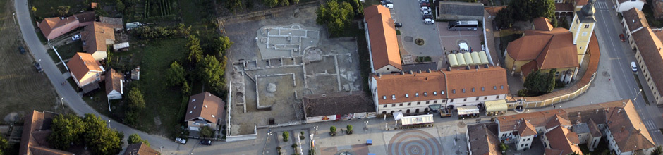
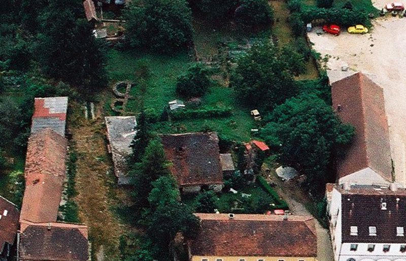
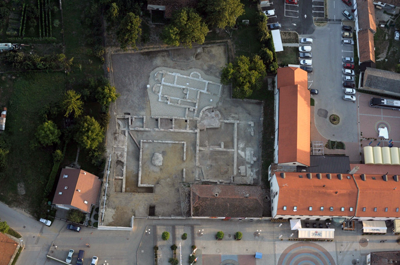
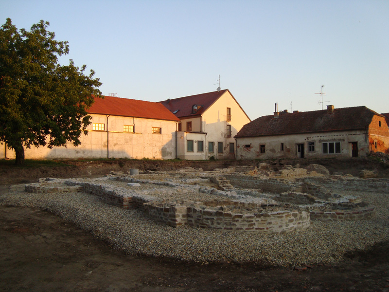
Due to the discovery of the two pools, which have incited scientific discussion ever since they were found, in 2008 archaeologists of the Division for Archaeological Heritage of the Croatian Conservation Institute continued the excavations in the Somođi Garden. Thanks to the attention the Town of Ludbreg pays to its cultural heritage and the awareness of the citizens of Ludbreg of their ancient legacy, the conditions were met (primarily those regarding property rights and finances) for the successful continuation of the work. The Town had secured ample space for the exploration (around 4000 m²), thus preventing the usual problem archaeological excavations face when carried out in urban centres: the narrow space and present-day active infrastructure.
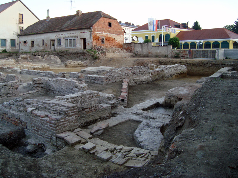
The entire area of the Somođi Garden had been devastated by post-mediaeval, modern and present-day construction interventions. As demonstrated during the first archaeological excavations, the centre of modern Ludbreg was continuously inhabited over the past two millennia. Each new generation completely demolished older structures to build the new ones. Hence, there was no stratigraphy and it was only possible to determine a mixture of layers, from the La Tène culture to modern layers (visible mainly as installations and sewers). The Somođi Garden was also intersected (and therefore devastated) by many utility installations and modern infrastructure.
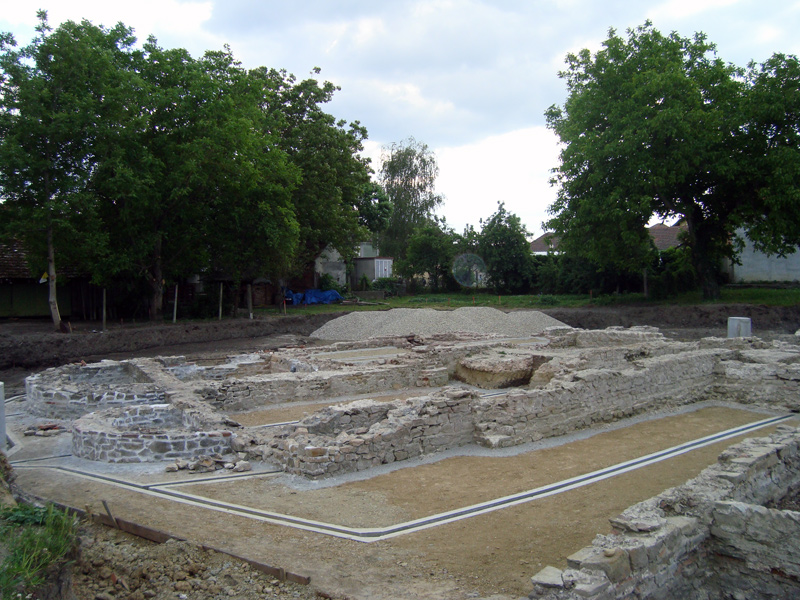
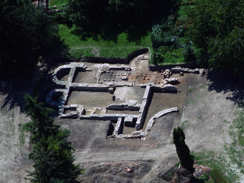
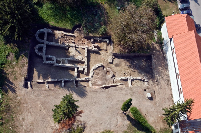
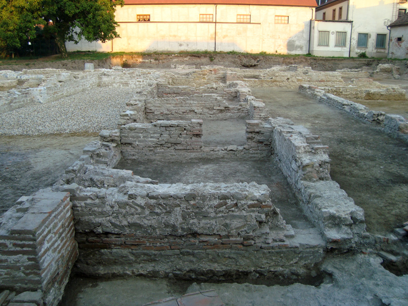
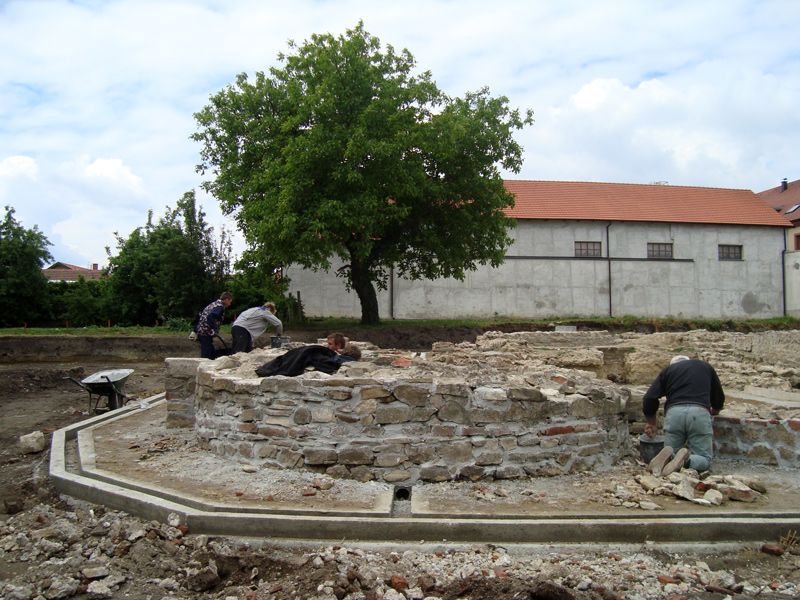
During the first two seasons of excavations (2008-2009), a small balnea (structure 1) situated in the south-eastern part of the Somođi Garden was discovered. The Iovian baths (231 sq m) belong to a group of smaller city baths, widespread throughout the Empire. Built as compact, unpartitioned buildings (Blocktyp), they fulfilled the rules of economical and structural efficiency.
The entrance of the Iovia baths, emphasized by a portico, was located in the northwest part of the complex. The door led to a sequence of four smaller rooms, presumably used for changing (apodyteriaor a similar auxiliary function. The northern rectangular room was divided into two parts, completed on the eastern side with a horseshoe-shaped pool. During the excavation of this section, no traces of any heating system were discovered, such as hypocaust supports (pilae) or hollow bricks (tubuli), allowing the conclusion that the entire space had not been heated, and that the pool had been filled with cold water (frigidarium). To the south of the non-heated section of the baths, an area of equal length, divided into four parts, was explored. In two of these rooms, well-preserved segments of hypocaust supports were found, suggesting that this section of the baths had been heated. The supports were made of bricks of the usual size (bessalis). Since most of the supports have been preserved to the height of one brick, it cannot be established how high they were. On the eastern side, the heated section of the baths was completed with a horseshoe-shaped pool. The large quantity of tubuli and hypocaust supports found in the pool suggests that the pool was filled with heated water (caldarium). On the southern side of the heated pool, there was another horseshoe-shaped pool. Its location within the baths complex suggests that this pool was also filled with heated water. On the eastern side of this part of the baths complex, there was a small rectangular room, which, due to its position adjacent to the furnace room (praefurnium), can be described as a sauna (sudatorium or laconicum). The sauna room with its entire width stands out of the western construction line of the facility. The heated section was completed with the furnace room on the western side (but its northwest segment has been destroyed by modern-day building).
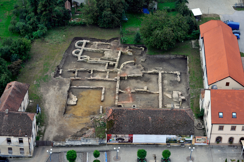
On the northern side of the baths (structure 1), the structure 2 was discovered. The dimensions had to be estimated by extrapolation and mirroring symmetry of all collected data with ILRIS-3D laser scanning because of the Somođi house and its very deep foundations. Its western façade was defined by a colonnaded portico. Through the porch one could enter a wide space divided into five rectangular rooms. This building was remodelled during several construction phases, but it is still not possible to deduce their precise sequential order or how they changed the primary function of the main building. This point is mainly emphasized with two constructional interventions. The first was a large semi-circular space that was built alongside the southern façade of the south-eastern room of the main building, while the second one was done along the eastern façade. With a bias of 2° in relation to the southern façade of the structure’s main section a (presumed) rectangular space was built.
The courtyard was framed by spacious corridors on all four sides. Unfortunately, only the southern wing, consisting of five rectangular rooms, linked by well-preserved doors, could be entirely explored. Taking into consideration that the Romans applied the principle of symmetry in their architecture, one might assume that the northern wing was organized in a similar (or equal) fashion. Although only the western part of the eastern wing could be explored, it has been confirmed that the space was organized according to the same ground-floor distribution which was present in the western section of the building: the wing was divided into three rectangular rooms along its north-south axis, with the southern-most room completed by a semi-circular wall. Due to the restriction of excavations on the adjacent privately-owned plot, the eastern construction line of the entire facility has been established by geo-radar.
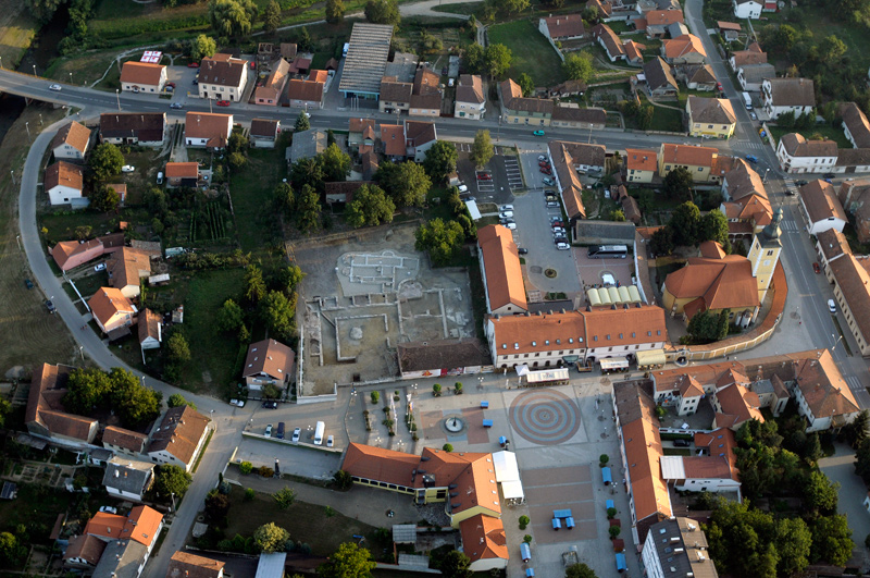
Survey plans (made with the application of 3D laser scanning and completed with reconstructed dimensions of the structure 2) have been incorporated into the cadastral layer and compared to aerial photographs.
Iovia - Ludbreg: an archaeological park in the making
The decision to pursue the idea of presenting this Roman site was made on the basis of several factors. First, that was the clear scholarly value, as new data will enhance the rather meagre knowledge of Roman settlements in the Croatian part of Roman province of Pannonia. Equally important was the enhancement of cultural (very few archaeological parks in Croatia), social (awareness of the Roman heritage by the local population) and economic (endorsing small and medium-sized local businesses) value. Furthermore, since the site is easily legible and therefore relatively simple to present, it would be a great loss not to make the most of its educational value. Because of these factors, instead of reburying after excavations, the decision was made to present this site as an archaeological park and open-air museum.
A cost effectiveness study concerning the modes of presentation and final conservation of this archaeological site was compiled. Employing management principles, the project’s main vision is to open a self-sustaining, open-air museum within ten years (as of the beginning of excavations). The mission statement was formulated through the scholarly aim of supplementing knowledge on the Croatian part of the Roman province of Pannonia and making this site a mainstay of Outdoor Education Days (required by the curricula of elementary and secondary schools). Another mission principle was the strategy rooted in the merger of strong religious tourism (based on pilgrimages to the Shrine of the Precious Blood of Christ) as well as with other open-air museums in the northern parts of the Roman province of Pannonia e.g. Flavia Solva (Leibniz, Austria), Poetovio (Ptuj, Slovenia) and Aquae Iasae (Varaždinske Toplice, Croatia). The value of this site is defined by making it the hub of successful collaboration between the local community and researchers. It is hoped that the open-air museum will effectively meld both scholarly and popular demands, up-to-date techniques of excavation and documentation, proper conservation and restoration methods and a diverse tourism product. By adhering to these principles, we ensured that this valuable archaeological site would avoid the fate of excavated monuments that were later abandoned and forgotten.
The foundations of the baths excavated in 1969 and 1971 were conserved with cement mortar. Before its repair, this part was used for experiments on application of different types of stone and binding materials. By using these data, it was possible to gain insight into the best way to permanently preserve the entire site. Based on observation of the applied materials, the decision was made to proceed with conservation - restoration works by using limestone from the local quarry (most closely matching the features of the original stone) bound with a lime mortar mixture. Testing of the different mixtures is ongoing, and the one that meets all specifications will be used as the final solution.
After the completion of the conservation - restoration works on the foundations and the construction of a drainage system, the original Roman walking surface will be levelled. Alignment with the higher surrounding level will be accomplished with several unobtrusive low steps, thus avoiding visually aggressive fences and structures. All communications will be adapted for disabled persons and strollers.
The presentation plan was drafted with regard to the site’s specific situation. The plan encompassed the scholarly and professional demands concerning conservation in situ, combined with the needs of successful cultural management, thus resulting in alignment between the latter two factors as well as cost effectiveness. Since excavations at the site are drawing to a close, it was possible to launch a conservation study. Given the fact that mainly building foundations were found (due to the aforementioned reasons), a decision had to be made as to how to present them. Complete restoration (in the manner of Carnuntum, present-day villages of Petronell and Bad Deutsch-Altenburg, Austria) was out of the question due to the lack of data. Presentation of the site at ground level was dismissed because in the long run it is very expensive to maintain and also hard for visitors to understand. Building a structure over the entire site would be very complex and rather difficult to justify. Reburial of the site was not taken into consideration due to all of the reasons cited above. Therefore, conservation of the foundations and restoration of the walls in a height of approximately 110 cm was chosen, as this will secure clear visual communication with visitors. Although this solution is not ideal (and since researchers could only advise and make any final decisions), the municipal authorities were very clear that the chosen method would have to satisfy the needs of their comprehensive socio-economical development plan.
At each visually expressive point, a 3D reconstruction with a brief, simple explanation will be set up, thus emphasizing the accessibility of information. In the north-eastern part of the site, several Roman military tents with Roman games (latrunculi, reges, duodecim scripta etc.) will be displayed. The whole site, according to the landscaping study, will be defined with “green walls” that will also define the boundaries with neighbouring properties. A dilapidated two-storey building in the north-eastern corner of the estate was torn down, thus improving the visual ambience and making space for the educational corner. The south-eastern part of the Somođi Garden will be left unexplored for the next generations and future technology.
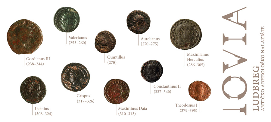
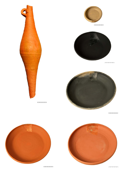
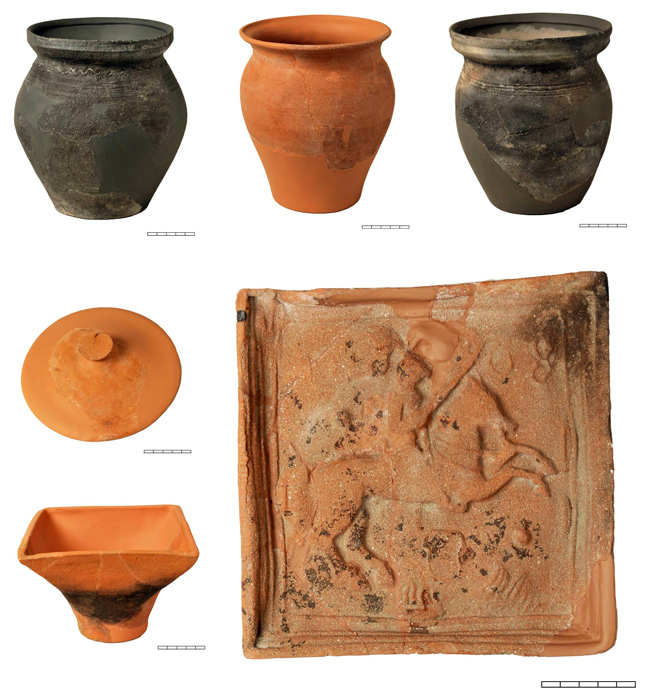
The only remaining building on the estate (the Somođi house) will be reused. One part will be remodelled as the head office of the tourism board. Among its primary functions, it will provide exemplary protection of the site and enable monitoring of the entrance. A small museum will be arranged in the other part of the Somođi house. A permanent display, formed as a cross section of Ludbreg from prehistory to the present, will be based on archaeological finds, i.e., a glass La Tène bracelet, Roman coins and Roman, medieval and Early Modern pottery. The excavated part of Roman Iovia will be explained through 3D interactive models and videos. The Ministry of Tourism will finance maintenance of the tourism board and Varaždin County will finance the museum. The third part of the Somođi house will (probably) be converted into an exclusive wine cellar. The annual lease revenues will be directly used to maintain the site.
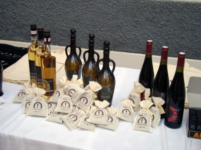
The first series of souvenirs with a trademark (Iovia-Ludbreg) were introduced to successfully promote Iovia. These souvenirs were made in cooperation with the municipal authorities and produced exclusively by local small and medium-sized businesses, thus serving as an anti-recessionary measure. The collection is represented by two Roman coins (a nummus of Maximianus and a denarius of Lucilla, both made of Zamak, an alloy of zinc, aluminium, magnesium and copper), Conditum paradoxum (made according to the instructions from De Re Coquinaria by Apicius), Mel Ioviae (acacia honey), Spiritus mellis Ioviae (mead) and Spiritus pruni cerasi Ioviae (cherry brandy), an homage from Ludbreg’s beekeepers and winemakers to their Roman ancestors. Apart from these souvenirs, a collection of environmental tote bags, T-shirts, caps, mugs, etc., all with the Iovia-Ludbreg trademark, will also be available.
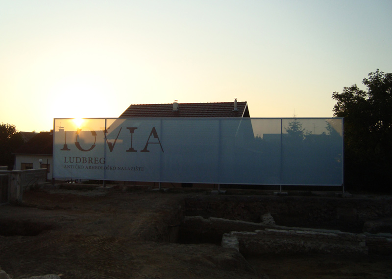
Since all of these activities brought immense changes to the small town of Ludbreg, it was necessary to raise the local population’s awareness: therefore, a mesh banner with aerial photographs, a 3D display and a simple text were set up in the main square (near the main entrance to the site), which were updated at the end of each season of excavations. Any suggestions for improvements to this public project can be made on the town’s official web site. There is also a strong media campaign (Internet, television, daily press) as well as annual public lectures that inform the wider public of the progress of excavations.
The Iovia-Ludbreg project can be considered a model of successful, interdisciplinary collaboration between the national government, municipal authorities and researchers, all of them acting for the benefit of the site and its visitors. Cost effectiveness was achieved through adherence to legal guidelines and fundamental management principles. By applying all of the aforementioned principles, which were set forth more as guidelines than rigid edicts, it was possible to provide a sound, legally secure future for this site.
Selected bibliography
- BRUNŠMID, Josip, Antikni bronsani predmeti u Hrvatskom narodnom muzeju u Zagrebu, VAD 13, Zagreb, 1914, pp. 207-268.
- DEGBOMONT, Jean-Marie, Le chauffage par hypocauste dans l'habitat privé, Liège, 1984.
- DELUKA, Aleksandra et al., Roman roads in Croatia, Proceedings of the First International Congress on Construction History, Madrid, 2003, pp. 733-742.
- DURM, Josef, Handbuch der Architektur (Zweiter Teil: Die Baustille. Historische und Technische Entwickelung; Zwieter Band: Die Baukunst der Etrusker, Die Baukunst der Römer), Stuttgart, 1905.
- EGGER, Rudolph, Historisch - topographische Studien in Venezien, Jahreshefte des Österreichischen Archäologischen Institutes 21-22, Vienna, 1924, pp. 327-341.
- GRAČANIN, Hrvoje, Rimske prometnice i komunikacije u kasnoantičkoj južnoj Panoniji, Scrinia Slavonica 10, Slavonski Brod, 2010, pp. 9-69.
- GREGL, Zoran, MIGOTTI, Branka, Civitas Iovia (Botivo), Situla 42, Ljubljana, 2004, pp. 131- 143.
- HEINZ, Werner, Römische Thermen - Badewesen und Badeluxus im Römischen Reich, München, 1983.
- JARAK, Mirja, Panonske ranokršćanske općine i problem kasnoantičkog kontinuiteta,OA 13, Zagreb, 1988, pp. 69-78.
- MAYER REPPERT, Petra, RABOLD, Britta, Die römischen“Soldatenbäder“ in Baden-Baden (Aquae Aureliae), Stuttgart, 2008.
- MIGOTTI Branka, Early Christianity in Aquae Iasae (Varaždinske Toplice) and Iovia (Ludbreg) in Pannonia Savia, Zalai Múzeum 11, 2002, pp. 51-66.
- MÓCSY, András, Pannonia and Upper Moesia, London-Boston, 1974.
- PLEŠE, Tajana 2012, The Results of Cultural Management of the Croatian Archaeological Heritage with Special Consideration for Cost Effectiveness: The Case of Roman Iovia (Ludbreg), Conservation and Management of Archaeological Sites 14 (1-4), London – Leeds, 310-321.
- SCHALLES, Hans Joachim et al., Die römischen Bäder, Cologne, 1989.
- TOMIČIĆ, Željko, Arheološka topografija i toponimija (Iovia - Botivo - Ludbreg) in: Ludbreg - Ludbreška Podravina (eds. Horvat Levaj, K., Reberski, I.), Zagreb, 1997, pp. 21-41.
- VIKIĆ BELANČIĆ, Branka, Sustavna istraživanja u Ludbregu 1968.-1979. godine, VAMZ n.s. 3 XVI-XVII, Zagreb, 1984, pp. 119-166.
- YEGÜL, Fikret, Baths and Bathing in Classical Antiquity, The MIT Press, 1992.